
Make good decisions when it matters.
We want communities to be safer. So we combine what we see on site with geodata and modelling, turn it into risk information you can act on, and help you find the measures that reduce the risk.
Services
01
See what’s there.
We combine site visits, satellite observations, open geodata and your own records to build a clear picture of the ground as it is today.
02
Know what’s coming.
We model how water, weather and climate can hit your area, at the level of detail the decision needs.
03
Decide what comes first.
We assess what is at stake and rank the measures that make a difference, so you know where to start and what to expect.
04
Make risk make sense.
A risk nobody understands is a risk nobody acts on. We build the maps, visuals, tools and warnings that reach the people who have to act.
Safer communities start with risk people understand.
We work to make communities safer from flooding, climate risk and other natural hazards. We look closely: on site, in the data and in our models. We say clearly what the risk is. And we help you find the measures that reduce it.
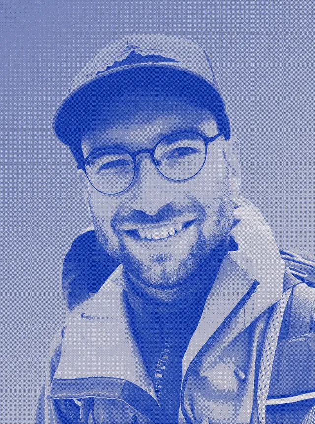
Muddy boots, clean data.
We think in landscapes, work in data, and measure our work by what people do with it. We are as much at home on site, in maps and in flood models as in the room where the decision gets made.
geofare was founded by geologist Niklas Jordan. He explains why:
“Too much good hazard science never reaches the people who have to decide. I started geofare to change that.”
A team built around your needs.
We are a network of experts. For each project we put together the team it needs: the right people for the job, and no layers in between. You always know who is doing the work.
What we stand for.
Curious
We are nerds, and we love what we do. Landscapes, water, data, models: we want to know how things really behave, and we keep digging until the picture holds. We work rigorously and from evidence, and we are happiest when a hard question turns up.
Practical
We believe knowledge is only worth something when someone can use it. So we prefer a useful answer in time to a perfect one too late. And because people can only act on what they understand, we make our work accessible and usable for the people who have to work with it.
Open
We are open by default, because we believe tools get better and communities get safer when knowledge is shared. We build on open-source technology and work in the open whenever we can.
Impact-driven
We do this to make a difference, not to fill shelves with reports. Our goal is that every project leaves you in a stronger position: clearer about your risk, surer of your next step, and better prepared than before.
Different sectors. Same question.
A municipality, a grid operator and a bank have little in common, until the water rises. Then they all ask the same thing: what can hit us, and what do we do about it? Here is how we answer it for each of them.
Municipalities
You have to adapt, with a limited budget and residents watching.
- See where flood and climate risk is highest, and what to tackle first
- Get the models and maps your adaptation plan needs, and no more
- Explain the plan so residents get on board
Emergency management
You need to know what is coming, who it hits and how to reach them.
- Scenarios you can plan and train with
- Warnings people understand and act on
- Maps and dashboards that work in an operations room, not only in a report
Urban planners & developers
What you plan today stays for decades. Check the risk before it is built in.
- Flood modelling for your site or plan area
- Quick risk screening early, while changes are still cheap
- Visuals that make the risk clear to decision-makers and the public
Housing associations & property owners
Your buildings cannot move, but their protection can improve.
- Flood risk per property, across your whole portfolio
- Practical measures, ranked by what to do first
- Plain information for residents and tenants
Government & infrastructure
Your roads, rail and networks face conditions they were not built for.
- Risk assessments for assets and networks, across hazards
- Satellite and geodata monitoring for large areas
- Tools your own teams can run
Finance & insurance
You need to know the physical risk in your portfolio, and show how you know.
- Portfolio screening for flood and climate hazards
- Risk down to the single address or asset
- Methods documented well enough for reporting and due diligence
Energy & utilities
Your assets are long-lived, often exposed, and everyone depends on them.
- Hazard checks for new sites before you commit
- Risk assessments for plants and networks
- Adaptation plans for what is already built
Built in the open.
This is our lab. When we need a tool and can’t find it anywhere, we build it ourselves and publish it. Free for you to use.
Launching soon
FloodReady.dk (opens in a new tab)
A free flood risk check for every Danish home. It turns public flood data on storm surge, cloudbursts, groundwater and watercourses into one clear grade per address, from A to F.
Open Source
Vindy.dk (opens in a new tab)
An interactive weather map of Denmark with forecasts, observations and radar. Built on open data from DMI and other official sources. Free and open source.
Open Source
MeteoAlarm for Python (opens in a new tab)
An open-source Python package that gives developers easy access to official weather warnings across Europe. It reads the MeteoAlarm warning feeds and filters them by country, severity and type.
Have a decision coming up?
Tell us what you need to know. We will tell you what it takes to find out.